Challenges faced by the mining industry
The mining industry grapples with significant challenges that impact its operations at various stages. One key hurdle is the volatility of commodity prices, which can fluctuate due to global economic conditions, trade tensions, and geopolitical uncertainties. Such fluctuations directly influence the profitability and investment decisions of mining companies, making it crucial for them to adapt to changing market dynamics swiftly.
Another pressing challenge is the increasing regulatory scrutiny and environmental concerns surrounding mining activities. Stricter regulations on environmental protection and community engagement require mining companies to invest heavily in compliance measures, impacting their operational costs and timelines. Balancing the need for resource extraction with sustainable practices poses a continuous challenge for the industry as it strives to maintain a social license to operate amidst growing environmental consciousness and stakeholder expectations.
• The volatility of commodity prices due to global economic conditions, trade tensions, and geopolitical uncertainties
• Increasing regulatory scrutiny and environmental concerns surrounding mining activities
• Stricter regulations on environmental protection and community engagement requiring heavy investment in compliance measures
• Balancing the need for resource extraction with sustainable practices to maintain a social license to operate
Benefits of integrating geospatial technology in mining operations
Geospatial technology plays a crucial role in enhancing the efficiency and effectiveness of mining operations. By providing real-time data and spatial analysis capabilities, geospatial technology enables mining companies to make informed decisions, optimize workflows, and maximize the utilization of resources. This results in cost savings, improved productivity, and better overall operational performance.
Furthermore, the integration of geospatial technology in mining operations allows for better monitoring and management of mining activities. This technology enables companies to track equipment and personnel locations, monitor environmental impacts, and detect potential hazards in real time. By having a comprehensive view of their operations through geospatial technology, mining companies can proactively address issues, improve safety measures, and minimize risks, ultimately leading to a safer working environment for all involved.
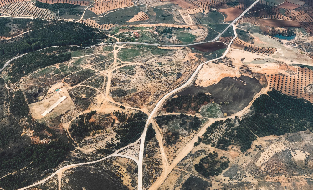
Role of geospatial technology in exploration and prospecting
Geospatial technology plays a crucial role in revolutionizing the exploration and prospecting processes within the mining industry. By utilizing advanced satellite imagery, Geographic Information System (GIS) data, and remote sensing techniques, mining companies can analyze vast terrains comprehensively and pinpoint potential mineral deposits with greater accuracy than traditional methods.
Through geospatial technology, mining professionals can overlay various geo-referenced datasets to create detailed maps and 3D models of exploration sites, allowing them to visualize and interpret geological features more effectively. This integrated approach enables expedited identification of high-potential areas for further investigation, streamlining the exploration phase and increasing the likelihood of discovering economically viable mineral reserves.
Applications of geospatial technology in mine planning and design
Geospatial technology plays a crucial role in mine planning and design by providing accurate and detailed data for decision-making processes. Through the use of geographic information systems (GIS) and remote sensing technologies, mining companies can create comprehensive maps and 3D models of their mining sites. These spatial data tools enhance the understanding of the terrain, geological structures, and mineral deposits, allowing for more precise planning of excavation and optimal design of mine layouts. Such detailed mapping helps in identifying potential risks and optimizing resource utilization during the mine planning phase.
Furthermore, geospatial technology enables mining engineers to conduct slope stability analysis, geotechnical assessments, and underground infrastructure planning with greater efficiency and accuracy. By integrating geospatial data into mine planning and design processes, mining operations can be streamlined and resources can be managed more effectively. The visualization capabilities of geospatial technology also aid in presenting complex information in a clear and actionable manner, facilitating collaboration among different stakeholders involved in the mine planning and design process.
Use of geospatial technology in monitoring and managing environmental impacts
Geospatial technology plays a crucial role in the monitoring and management of environmental impacts in mining operations. By utilizing advanced mapping and data analysis techniques, companies can track changes in the environment, such as land use, vegetation cover, water quality, and air pollution. This real-time monitoring enables timely decision-making to address any potential environmental issues that may arise during mining activities, ensuring compliance with regulatory requirements and sustainable practices.
Furthermore, geospatial technology allows for the creation of detailed environmental impact assessments (EIAs) by integrating spatial data with environmental parameters. Through the use of Geographic Information Systems (GIS), mining companies can visualize the potential effects of their operations on the surrounding ecosystem and identify sensitive areas that need special attention. By incorporating geospatial technology into environmental monitoring and management processes, mining operations can mitigate impacts, protect natural resources, and maintain a harmonious relationship with the environment.
Integration of geospatial technology in resource estimation and inventory management
Geospatial technology plays a pivotal role in resource estimation and inventory management within the mining industry. By leveraging advanced mapping and geographic information systems, mining companies can accurately identify and quantify mineral reserves with precision. This technology enables mining engineers and geologists to create detailed 3D models of the deposit and assess its volume, grade, and quality, leading to informed decision-making in resource evaluation.
Moreover, geospatial technology facilitates efficient inventory management by providing real-time tracking and monitoring of materials throughout the mining process. By integrating location-based data, mining companies can optimize their stockpile management, track ore movements, and streamline the supply chain operations. This level of visibility and control over inventory not only enhances operational efficiency but also minimizes the risk of stockouts or excess stock, ultimately improving the overall profitability of mining operations.
Role of geospatial technology in improving safety and security in mining operations
Geospatial technology plays a crucial role in enhancing safety and security in mining operations. By utilizing real-time tracking and monitoring systems, mining companies can efficiently locate and communicate with workers in case of emergencies. This technology enables managers to quickly assess potential hazards and implement precautionary measures to mitigate risks to personnel and equipment.
Furthermore, geospatial technology helps in identifying high-risk zones within mining sites, allowing for proactive planning and implementation of safety protocols. Through the integration of geospatial data with predictive analytics, companies can foresee potential safety issues and take preventive actions. By providing a comprehensive view of the mining environment, geospatial technology aids in creating a safer workplace for employees, ultimately reducing accidents and improving overall operational security.
Utilization of geospatial technology in optimizing transportation and logistics in mining
Geospatial technology plays a crucial role in optimizing transportation and logistics in the mining industry. By utilizing advanced mapping and spatial analysis tools, companies can effectively plan and manage the movement of materials, equipment, and personnel within mining operations. This results in improved efficiency, reduced costs, and enhanced safety in the transportation process.
One key benefit of integrating geospatial technology in transportation and logistics is the ability to track and monitor assets in real-time. Through the use of GPS tracking and geofencing technologies, mining companies can gain better visibility into the location and status of vehicles, shipments, and personnel. This real-time data enables companies to proactively identify potential bottlenecks, streamline routes, and make informed decisions to optimize transportation workflows.
Incorporating geospatial technology in mine rehabilitation and closure planning
Geospatial technology plays a crucial role in mine rehabilitation and closure planning by providing detailed spatial information about the site. This technology allows for the effective monitoring of rehabilitation progress and helps in designing optimal closure plans to ensure environmental sustainability. By utilizing geospatial data, mining companies can accurately assess the condition of the land post-mining activities and implement targeted rehabilitation efforts.
Additionally, geospatial technology aids in the visualization of potential environmental impacts during the closure phase, enabling proactive measures to mitigate any adverse effects. Through the integration of geographic information systems (GIS) and remote sensing technologies, mining companies can create comprehensive digital models of the site, facilitating better decision-making in the rehabilitation and closure processes. This advanced technology enhances the efficiency and effectiveness of mine closure strategies, ultimately contributing to long-term environmental conservation and community well-being.
Impact of geospatial technology on increasing operational efficiency and productivity in mining
Geospatial technology plays a crucial role in enhancing operational efficiency and productivity within the mining industry. By integrating geospatial data into various mining operations, companies can streamline their processes and make more informed decisions. Through the use of advanced mapping, monitoring, and analytical tools, mining companies can optimize their workflows, identify operational bottlenecks, and improve overall productivity.
Furthermore, geospatial technology enables mining companies to track assets, equipment, and personnel in real-time, leading to better resource allocation and utilization. This real-time visibility allows for proactive maintenance scheduling, minimizing downtime and maximizing operational efficiency. Additionally, the ability to accurately monitor stockpiles, ore grades, and environmental factors using geospatial technology contributes to better planning and decision-making, ultimately resulting in increased productivity and profitability for mining operations.
Future trends and advancements in geospatial technology for the mining industry
Geospatial technology continues to evolve rapidly, with future trends focusing on enhancing automation and data analytics in mining operations. One key advancement is the integration of artificial intelligence and machine learning algorithms to process and analyze geospatial data more efficiently, allowing for quicker decision-making and improved resource management. Additionally, the development of real-time monitoring systems using remote sensing technologies is set to revolutionize how mining processes are monitored and controlled, increasing safety and efficiency on-site.
Another significant trend in geospatial technology for the mining industry is the increasing use of virtual and augmented reality applications for mine planning and visualization. These technologies enable stakeholders to immerse themselves in digital representations of mining sites, facilitating better understanding and communication of complex data. Furthermore, the incorporation of drones and advanced sensors for mapping and surveying purposes will further streamline data collection processes, providing accurate and up-to-date information for operational planning and environmental management.
Case studies showcasing successful implementation of geospatial technology in mining projects
Geospatial technology has revolutionized the mining industry, with numerous success stories showcasing its implementation in various projects around the world. In one case study, a mining company in Australia leveraged geospatial technology to streamline their exploration and development processes. By integrating satellite imagery and geographic information systems (GIS), the company was able to identify new mineral deposit locations with increased accuracy and efficiency, leading to significant cost savings and accelerated project timelines.
In another notable case, a mining operation in South America utilized drones equipped with LiDAR technology for mapping and surveying purposes. This technological advancement allowed the company to collect precise topographic data in a fraction of the time it would take using traditional methods. As a result, the mining project was able to optimize mine planning processes, improve operational safety, and enhance environmental monitoring practices. These case studies highlight the immense potential of geospatial technology in driving innovation and success in the mining sector.
Considerations for choosing the right geospatial technology solutions for mining operations
Selecting the most suitable geospatial technology solutions for mining operations is a critical process that requires careful consideration of various factors. Firstly, it is essential to assess the specific needs and objectives of the mining project to determine the functionalities and features required in the geospatial technology solution. Understanding the scope and scale of the operation, as well as the complexity of the geological environment, will help in identifying the most compatible technology that aligns with the project requirements.
Additionally, evaluating the compatibility and interoperability of the geospatial technology solution with existing systems and software used in the mining operation is crucial for seamless integration and data exchange. Ensuring that the chosen technology can effectively communicate and share data with other tools employed in the mining process will enhance efficiency and effectiveness in operations. Furthermore, considering the scalability and flexibility of the geospatial technology solution to adapt to potential changes and future advancements in the mining industry is vital for long-term sustainability and growth.
Additional Resources:
[newsletter]
Table of Contents
Categories:
- Additive Manufacturing
- Advanced Equipment
- Asset & Resource Management
- Automation & Robotics
- Big Data & Analytics
- Bio-mining
- Cloud Computing
- Cybersecurity
- Deep Sea Mining
- Digital Transformation
- Emerging Technologies
- Environmental Stewardship
- Geospatial Technologies
- Materials Science
- Mine Planning & Optimization
- Mining 4.0
- Mining Safety
- Ore Processing & Sorting
- Predictive Maintenance
- Satellite & Drone Exploration
- Smart Mining
- Smart Transport Solutions
- Uncategorized
- Wearable & Monitoring Tech
Latest posts:
FAQs:
What are some key considerations for choosing the right geospatial technology solutions for mining operations?
Some key considerations include the specific needs of the mining operation, the scalability and flexibility of the technology, the compatibility with existing systems, the level of support and training provided, and the cost-effectiveness of the solution.
How can geospatial technology help in improving safety and security in mining operations?
Geospatial technology can help in identifying potential hazards, monitoring equipment and personnel in real-time, analyzing data to prevent accidents, and enhancing emergency response capabilities.
How does geospatial technology contribute to resource estimation and inventory management in mining?
Geospatial technology helps in accurately mapping and assessing the quantity and quality of resources, monitoring their extraction and depletion, optimizing inventory levels, and ensuring sustainable resource management.
What role does geospatial technology play in mine rehabilitation and closure planning?
Geospatial technology is instrumental in creating detailed plans for restoring mined areas to their natural state, managing post-closure risks, monitoring environmental impacts, and facilitating regulatory compliance.
How can geospatial technology optimize transportation and logistics in mining operations?
Geospatial technology can optimize route planning, track vehicle movements, monitor traffic conditions, manage inventory and supply chains, and improve overall operational efficiency in transportation and logistics.
What are some future trends and advancements in geospatial technology for the mining industry?
Future trends include the integration of artificial intelligence and machine learning for data analysis, the use of drones and satellite imagery for remote sensing, the development of real-time monitoring solutions, and the adoption of cloud-based platforms for data storage and sharing.