How Satellite Imagery is Used in Mineral Exploration
Satellite imagery plays a crucial role in modern mineral exploration, offering a bird’s eye view of the Earth’s surface with unparalleled detail and coverage. By leveraging satellite data, geologists and mining companies can efficiently identify potential mineral deposits based on distinctive geological features and anomalies. These images provide valuable insights into terrain topography, land cover, and alteration patterns, aiding in the selection of promising exploration targets.
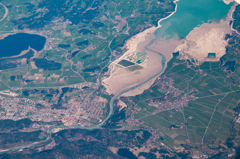
Furthermore, satellite imagery enables remote sensing of inaccessible or challenging terrains, reducing the need for extensive ground surveys and physical exploration. Through the use of multispectral and hyperspectral imaging, geologists can detect subtle mineral signatures that may indicate the presence of valuable resources beneath the surface. This non-invasive approach not only saves time and resources but also enhances the overall efficiency and effectiveness of mineral exploration projects.
Identifying Geological Structures with Satellite Imagery
Geological structures play a crucial role in mineral exploration, as they can indicate potential mineralization zones within the Earth’s crust. Satellite imagery has become a valuable tool in identifying these structures from a bird’s-eye view. By analyzing the patterns, shapes, and textures visible in satellite images, geologists can pinpoint faults, folds, fractures, and other structural features that may host valuable mineral deposits.
One of the key advantages of using satellite imagery for identifying geological structures is the ability to cover large areas quickly and cost-effectively. Traditional methods of ground-based mapping can be time-consuming and limited in scope, whereas satellite data provides a broad perspective that can reveal structural patterns over vast regions. This comprehensive view allows geologists to gain insights into the overall geological setting and better target their exploration efforts towards areas with the highest potential for mineral deposits.
Advanced Technologies for Analyzing Satellite Imagery in Mineral Exploration
Advanced technologies have revolutionized the process of analyzing satellite imagery for mineral exploration. One such advancement is the use of machine learning algorithms to automatically detect and classify geological features from satellite images. These algorithms can quickly process large amounts of data, leading to faster and more accurate identification of potential mineral deposits.
Furthermore, hyperspectral imaging technology has enabled geologists to analyze satellite imagery at a more detailed level than ever before. By capturing data across numerous wavelengths, hyperspectral imagery provides valuable insights into the composition of rocks and minerals. This advanced technology allows exploration teams to make more informed decisions about where to focus their geological surveys, ultimately improving the efficiency and success rates of mineral exploration projects.
Benefits of Using Satellite Imagery for Mineral Exploration
Satellite imagery offers numerous benefits for mineral exploration activities. One advantage is the wide coverage area that satellite images provide, allowing geologists and mining companies to study vast regions efficiently. This can lead to the discovery of new mineral deposits or the identification of previously unnoticed geological features. Additionally, satellite imagery can be obtained quickly and without the need for expensive fieldwork, saving both time and resources for exploration teams.
Furthermore, satellite imagery offers a non-invasive way to gather valuable data about various terrains and geologies. This remote sensing technology allows exploration teams to analyze areas that may be difficult to access on the ground, such as dense forests or remote mountain ranges. By utilizing satellite imagery, geologists can gain a comprehensive understanding of the geological structures and mineral potential of a region, ultimately aiding in the decision-making process for mineral exploration projects.
Challenges in Utilizing Satellite Imagery for Mineral Exploration
Despite the numerous advantages of satellite imagery in mineral exploration, there are certain challenges that need to be addressed to maximize its effectiveness. One of the primary obstacles is the limitation in spatial resolution, which can make it difficult to identify smaller mineral deposits or geological features accurately. This lack of detail can hinder the precise mapping of mineral occurrences and impede decision-making processes in exploration activities.
Another challenge revolves around the interpretation of imagery data, as it requires specialized knowledge and expertise. Misinterpretation or misclassification of features within satellite images can lead to incorrect assumptions about the presence or absence of minerals in a particular area. This emphasizes the need for continuous training and skill development of professionals in the field of mineral exploration to ensure accurate analysis and utilization of satellite imagery data.
Integration of Satellite Imagery with Other Exploration Techniques
Satellite imagery is a valuable tool in mineral exploration, providing a broad perspective that can be integrated with other exploration techniques to enhance overall understanding of geological features. By combining satellite imagery with ground-based methods such as geological mapping and geophysical surveys, geologists are able to pinpoint potential mineral deposits more accurately and efficiently. The high-resolution images captured by satellites allow for detailed analysis of surface features, aiding in the identification of key geological indicators that might not be visible through traditional exploration methods alone.
Moreover, the integration of satellite imagery with remote sensing technologies like LiDAR and hyperspectral imaging further improves the ability to detect subtle geological structures and mineral signatures. These complementary techniques enable geoscientists to create comprehensive models of the subsurface geology, potentially uncovering hidden mineralization targets that might otherwise go unnoticed. By leveraging the strengths of each exploration method, companies can maximize the probability of success in their mineral exploration endeavors while minimizing the risks associated with incomplete or inaccurate data interpretation.
Improving Accuracy and Resolution of Satellite Imagery for Mineral Exploration
Advancements in satellite technology have significantly enhanced the accuracy and resolution of imagery used in mineral exploration. High-resolution satellites now offer detailed images that can provide valuable insights into geological features and potential mineral deposits. By improving the clarity and precision of satellite imagery, geologists and mining companies are better equipped to make informed decisions and optimize their exploration efforts.
The development of advanced image processing techniques has further contributed to enhancing the accuracy of satellite imagery in mineral exploration. By utilizing sophisticated algorithms and software, geoscientists can analyze satellite data more effectively, enabling them to identify subtle geological features and anomalies that may indicate the presence of mineralization. These tools help in improving the interpretation of satellite data, allowing for more precise targeting of exploration activities and increasing the likelihood of successful mineral discoveries.
Case Studies Demonstrating the Success of Satellite Imagery in Mineral Exploration
Satellite imagery has proven to be a powerful tool in mineral exploration, aiding in the discovery of valuable deposits around the globe. In one case study, a mining company utilized high-resolution satellite images to identify potential mineral occurrences in a remote and challenging terrain. By analyzing the spectral signatures and geological features captured in the imagery, the company successfully pinpointed areas with high mineral potential, allowing for targeted exploration efforts that resulted in the discovery of a rich ore body.
Another success story involves the use of satellite imagery to monitor environmental impacts of mining activities. By comparing historical images with current data, a mining company was able to track changes in land use, vegetation cover, and water quality surrounding their operations. This proactive approach not only helped in mitigating potential environmental risks but also contributed to the company’s social responsibility efforts by ensuring sustainable mining practices.
• Satellite imagery helped a mining company identify potential mineral occurrences in remote terrain
• Analysis of spectral signatures and geological features led to the discovery of a rich ore body
• Targeted exploration efforts were made possible through satellite imagery
• Another success story involved using satellite imagery to monitor environmental impacts of mining activities
• Historical images compared with current data tracked changes in land use, vegetation cover, and water quality
• Proactive approach aided in mitigating environmental risks and promoting sustainable mining practices
Future Trends in Satellite Imagery for Mineral Exploration
With the rapid advancements in technology, future trends in satellite imagery for mineral exploration are expected to focus on enhancing the resolution and accuracy of images captured. High-resolution satellite sensors are being developed to provide more detailed geological information, allowing exploration teams to identify potential mineral deposits with greater precision. Additionally, the integration of artificial intelligence and machine learning algorithms is becoming increasingly popular in analyzing satellite imagery, enabling faster and more efficient identification of mineralization targets.
Another key trend in the future of satellite imagery for mineral exploration is the use of hyperspectral imaging technology. This advanced technique allows for the identification of specific minerals based on their unique spectral signatures, providing valuable insights into the composition of geological formations. By leveraging hyperspectral data, exploration teams can improve their understanding of mineral assemblages and optimize their exploration strategies accordingly.
Cost-Effectiveness of Satellite Imagery in Mineral Exploration
Satellite imagery has revolutionized the field of mineral exploration by offering a cost-effective alternative to traditional methods. The ability to survey vast areas from a bird’s-eye view significantly reduces the need for costly ground surveys and physical exploration, resulting in substantial cost savings for mining companies. This cost-effective nature of satellite imagery allows companies to allocate resources more efficiently, focusing on areas with high mineral potential and increasing the likelihood of successful exploration projects.
Moreover, the affordability of satellite imagery makes it accessible to a wider range of exploration companies, including small and medium-sized enterprises that may have limited budgets for exploration activities. By utilizing satellite imagery, these companies can conduct preliminary assessments of mineral prospects without incurring exorbitant expenses, enabling them to make informed decisions on further exploration efforts. The cost-effectiveness of satellite imagery thus levels the playing field in the mineral exploration industry, democratizing access to valuable geological data for companies of all sizes.
Environmental Impact Assessment Using Satellite Imagery in Mineral Exploration
Satellite imagery plays a crucial role in conducting environmental impact assessments for mineral exploration projects. By utilizing high-resolution satellite data, geologists and environmental experts can accurately monitor changes in land use, vegetation cover, and water bodies over time. This technology enables them to assess the extent of deforestation, soil erosion, and water pollution resulting from mining activities, helping companies comply with environmental regulations and minimize their ecological footprint.
Moreover, satellite images provide valuable insights into the potential environmental risks associated with mineral exploration sites. By analyzing patterns of land degradation and habitat destruction from a bird’s eye view, stakeholders can proactively identify areas of high ecological sensitivity that need protection. This proactive approach not only helps in mitigating negative impacts on biodiversity but also fosters sustainable development practices in the mining industry.
Regulatory Considerations When Using Satellite Imagery for Mineral Exploration
When incorporating satellite imagery into mineral exploration activities, it is essential to adhere to regulatory considerations set forth by governing bodies. These regulations aim to ensure that the use of satellite imagery is conducted in a responsible and compliant manner, with respect to privacy, data security, and environmental impact. By following these regulations, companies can demonstrate their commitment to ethical practices and accountability in their exploration endeavors.
Regulatory considerations may vary across different regions and countries, necessitating a thorough understanding of local laws and guidelines governing the use of satellite imagery in mineral exploration. It is imperative for companies to conduct due diligence and seek necessary permits or approvals before deploying satellite technology for exploration purposes. Compliance with regulatory requirements not only mitigates legal risks but also fosters trust and cooperation among stakeholders, reinforcing the credibility and integrity of the exploration activities.
Training and Skill Development for Effective Use of Satellite Imagery in Mineral Exploration
Training and skill development play a crucial role in harnessing the full potential of satellite imagery for mineral exploration. Professionals working in this field are required to have a deep understanding of image interpretation techniques, remote sensing technologies, and data analysis methods. By honing their skills in these areas, geologists and exploration teams can effectively identify mineral deposits, geological structures, and potential exploration sites from satellite images.
Continuous training programs and workshops enable professionals to stay updated with the latest advancements in satellite imagery technology, data processing software, and analytical tools. These opportunities not only enhance their proficiency in interpreting imagery but also help them refine their decision-making skills when selecting target areas for mineral exploration. Investing in training and skill development ensures that exploration teams are well-equipped to leverage the power of satellite imagery for improving the efficiency and accuracy of mineral exploration projects.
Additional Resources:
[newsletter]
Table of Contents
Categories:
- Additive Manufacturing
- Advanced Equipment
- Asset & Resource Management
- Automation & Robotics
- Big Data & Analytics
- Bio-mining
- Cloud Computing
- Cybersecurity
- Deep Sea Mining
- Digital Transformation
- Emerging Technologies
- Environmental Stewardship
- Geospatial Technologies
- Materials Science
- Mine Planning & Optimization
- Mining 4.0
- Mining Safety
- Ore Processing & Sorting
- Predictive Maintenance
- Satellite & Drone Exploration
- Smart Mining
- Smart Transport Solutions
- Uncategorized
- Wearable & Monitoring Tech
Latest Posts:
FAQs:
How is satellite imagery used in mineral exploration?
Satellite imagery is used in mineral exploration to identify potential mineral deposits by analyzing geological structures, land cover, and surface features from a bird’s eye view.
What are the benefits of using satellite imagery for mineral exploration?
The benefits of using satellite imagery for mineral exploration include cost-effectiveness, wide coverage area, remote access to hard-to-reach locations, and the ability to detect mineral deposits without physical exploration on the ground.
What are the challenges in utilizing satellite imagery for mineral exploration?
Challenges in utilizing satellite imagery for mineral exploration include limited resolution, cloud cover interference, data processing complexities, and the need for specialized training and skills to interpret the imagery accurately.
How can satellite imagery be integrated with other exploration techniques?
Satellite imagery can be integrated with other exploration techniques such as geophysical surveys, geochemical analysis, and field mapping to provide a comprehensive understanding of potential mineral deposits and improve decision-making in exploration activities.
What are the future trends in satellite imagery for mineral exploration?
Future trends in satellite imagery for mineral exploration include the use of advanced technologies like artificial intelligence, machine learning, and hyperspectral imaging to enhance data analysis, improve resolution, and increase the efficiency of mineral exploration processes.
How can training and skill development improve the effective use of satellite imagery in mineral exploration?
Training and skill development are essential to effectively use satellite imagery in mineral exploration as they help professionals interpret the data accurately, utilize advanced technologies for analysis, and integrate satellite imagery with other exploration techniques for optimal results.